Ascent 158m
Descent 220m
Today was our final leg of the Wealdway. Due to the way the previous sections had been divided, we only had about 7 miles to walk to Gravesend, but as the group is intending to walk the Saxon Shore Way next, and this conveniently starts in Gravesend, a more typical 14 miler was planned for the majority, with both the completion of the WW and start of the SSW. A few of us planned to stop at the finish of the WW, as we had other commitments later in the day. This also allowed Derek (who is waiting for a knee operation and is not allowed to walk long distances) to join us for this section.

Views from Luddesdown

Luddesdown church
Unlike the previous week, we had no trouble with the natives about parking in Luddesdown. There also did not appear to be a church service there that day, and the car park was pretty empty. The weather forecast for today was pretty good, but it was quite a chilly start.

Setting off

Entering the first veggie field
Setting off from the church, we climbed steps up from the road and entered a field full of vegetable crops, some covered by plastic sheeting. There were also a few polytunnels and some raspberry canes.

Polythene protection

Descending to cross the lane
Dropping down, we crossed a small lane and then continued to descend through another vegetable field. Looking west there was a lovely array of colours, with the white flowers of potato plants in the foreground, followed by an unidentified mauve plant, and finally the red hue of poppies in the distance. With the blue sky and scudding white clouds, it made a pretty picture (once we were passed the plastic, anyway).

Entering the second veggie field - with more polythene

Colourful stripes
Reaching the edge of the vegetable field, at the bottom of the valley, we had to step over a tiny electric fence, presumably intended to save the vegetables from destruction by Benjamin Bunny and friends.

Puffing up the hill

Walking along the scarp top
There was then a stiff climb up the other side of the valley, before swinging west briefly, to follow the escarpment. We soon left the field edge and climbed some steps into a small patch of wood, before passing under some pylons and emerging into a broad bean field, also teeming with wonderful poppies. The views to the northeast were very fine.

Is this a bean crop or a poppy crop?

Small pond
We soon reached a track and continued past a small pond. The sun was already warming things up nicely, and this, together with our pull up from the valley floor, resulted in some hasty removal of clothing layers.

Village shop - Sole Street
The track ended at a lane close to the small village of Sole Street. We walked up the road for about a ¼ mile, past a pub and over the railway bridge. The lane was surprisingly busy for an unclassified road. The route took us down a side road for a further ¼ mile and then left on a footpath again. We quickly reached the railway line and Dave realised we had gone ‘off piste’. Backtracking, we found the correct route along a path behind the houses – the WW sign had fallen off the post. It was fortunate that there had been such an obvious land mark as the railway to point out our error so soon.

Back on route - path behind the houses

Communal BBQs and seating areas
In the thin strip of woodland behind the houses, someone had built some BBQs and wooden seating, presumably for the use of the locals. At the end of the path, we crossed a quiet lane and then walked diagonally across a horse pasture.

Horse field

Overgrown field and view north towards Nursted church
Our route then skirted a rather overgrown grassy field, with views northwest towards the church near Nurstead Court. The field appeared to be used as a horse racing track as jumps had been built at intervals, but they had clearly not been used for some time as the grass was long and undisturbed.

Young trees

Summer meadow
We also passed a curious summerhouse and pond, complete with gravel and plant landscaping. I assume it is used for fishing, but this morning it was deserted. Crossing a lane, we continued along an enclosed bridleway, adjacent to a field of rampant ragwort, and parallel to Mill Hill (my birth place in northwest London, incidentally - and irrelevantly!).

Colourful lichen on the waymark

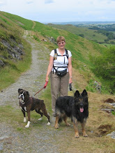
Me on the bridleway
Reaching a semi metalled track we swung due north to the small hamlet of Nash Street before continuing on the bridleway alongside a field of ripening wheat, and up a gentle incline towards a triple row of electricity pylons.

Distant views to Essex on the north bank of the Thames

Pylons & more pylons
At the top of the hill, the views opened out to the north towards the rather industrial north bank of the Thames. However, with the sun shining I thought it still had a certain beauty – yes really! As we continued across the large wheat field, the views became more urban.

Official path diversion

"Steady as you go, Maria"
The official pathway was diverted parallel to, rather than across the railway, and then descended to meet the A227. Here, Dave gave some assistance to some motorists trying to find the location of a wedding on the outskirts of Gravesend.

Tim by the A227

Under the A2
We then took a tortuous route alongside the main road, and across the roundabout interchanges under the A2. This required taking our life into our hands a number of times, as the motorists showed absolutely no courtesy or patience and would have had us standing like lemons on the pavement all day! There appeared to have been an accident on the A2, as there was some police patrol car activity and quite a build up of traffic.

Our route along the A227
Unfortunately our route now continued northwards along the A227 for about 2 miles, which was not the most attractive way to complete a long distance path. The pavement was quite narrow and the traffic fairly busy, but at least there was a cycle lane marked on the road to provide a small buffer between us and the cars.

Sundial
The walk into Gravesend was extremely dreary, although Dave did spot an interesting sundial high on the wall of one of the buildings - unfortunately the sun was behind a cloud at the time.

Civic Centre

Gravesend shopping centre
Things improved slightly as we reached the centre of town – there was a reasonably attractive area outside the Civic Centre, and the shopping precinct looked quite smart and clean. At St George’s church there was a statue of the Native American Princess Pocahontas, who was buried there in 1617.

St George's church

Admiring the Pocahontas statue
Finally we reached the banks of the Thames and the official end of the Wealdway. We had our photo taken by the WW notice board to commemorate the occasion (after accosting a passer by to do the honours for us), and then had a quick look at the Town Pier, which was built in 1834 and is the oldest surviving cast iron pier in the world.

Hurrah - another long distance path completed!

Derek & Zuka near the pier
After eating a quick sandwich overlooking the Thames, Anne, Derek & I said cheerio to the others who were continuing straight on with the Saxon Shore Way. Maria’s knee was playing up a bit, so she too opted to finish now, and catch the train home.

A quick bite to eat

River Thames
So, the 82 mile Wealdway is finished. On the whole it has been a very enjoyable walk, with a number of the legs having definite themes – stiles on WW2, ponds on WW3 and fruit orchards on WW5. It’s a great shame that it finished with such an ugly tramp into Gravesend. For walkers travelling south, the finish would be over the South Downs to finish on the sea front at Eastbourne – a much nicer prospect. I guess I’d better walk it all in the other direction someday, then!

The Wealdway

2 comments:
I've been thinking about walking this route for some time now, especially as I used to work in the Civic Centre in Gravesend! I think I'll use your suggestion of walking from North - South. Like the pictures - there are some great views
Most of our group particularly liked the leg that crossed Ashdown Forest - mind you the weather WAS glorious that day, which always helps!
Post a Comment